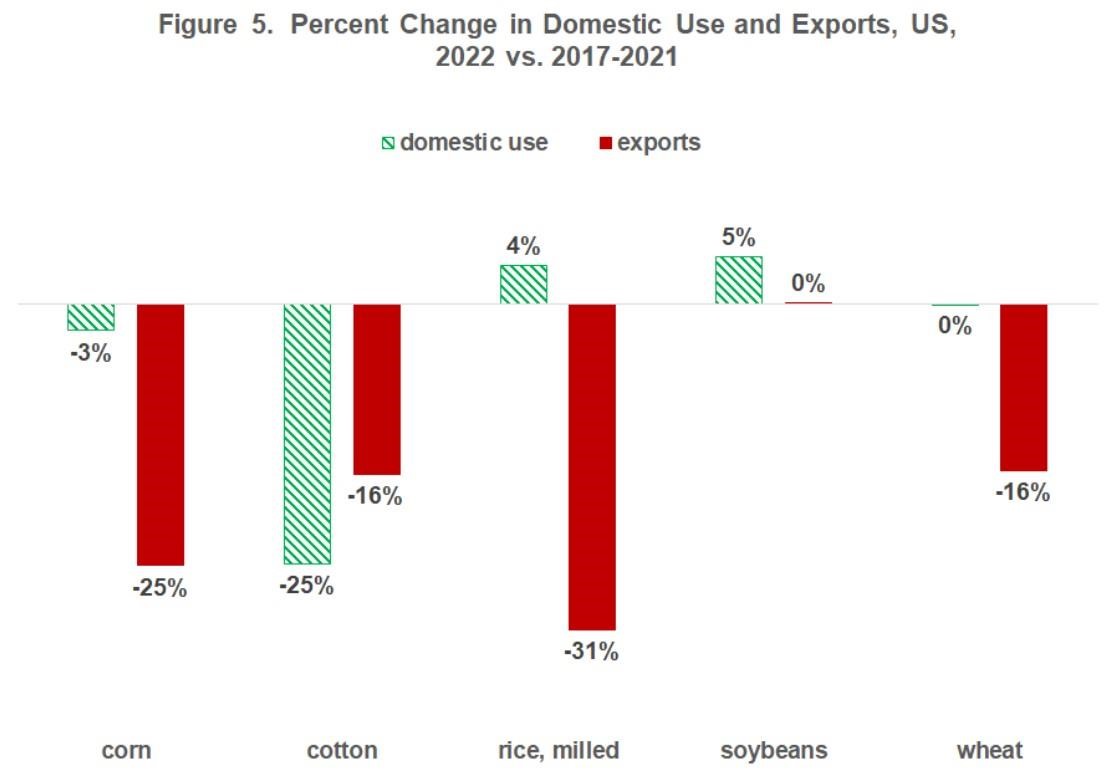
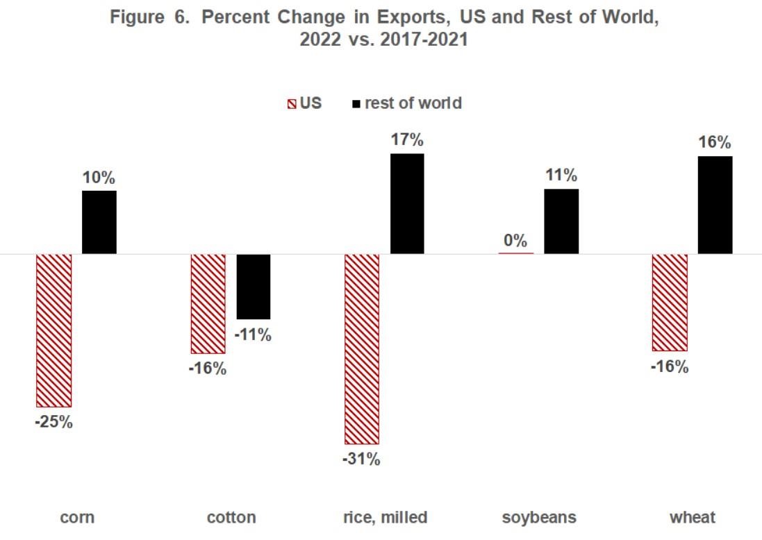
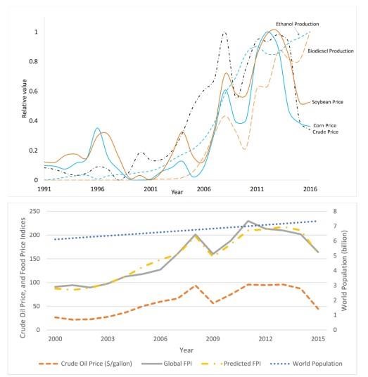
Figure 1: Daily average air temperature (dashed red), two-inch (green) and four-inch (blue) soil temperatures for spring 2023. Soil type and location of measurements (under sod or bare soil) are provided in the lower right corner of each panel. A map of all locations is in the bottom right. Data provided by the College of Food, Agricultural, and Environmental Sciences (CFAES) Agricultural Research Stations located throughout the state.

Figure 2: (Left) Total precipitation over the 7-day period of 7am April 25 – 7am May 1, 2023. Figure provided by the Midwestern Regional Climate Center. (Right) Calculated soil moisture percentiles as of 4/23/2023 according to the Climate Prediction Center.
Precipitation was heaviest across portions western and southeastern Ohio, where 1-2” fell (Figure 1). Isolated heavier amounts greater than 2” were observed across central and west central Ohio (see CoCoRaHS). Soils moisture remain adequate to damp across the state, with this week’s rain helping to curb drying trends experienced over the last 30 days. Much of the state is reporting soil moisture between the 30th and 70th percentile compared to historical conditions (Figure 2-right). For more complete weather records for CFAES research stations, including temperature, precipitation, growing degree days, and other useful weather observations, please visit https://www.oardc.ohio-state.edu/weather1/.
Weather Forecast
This week is starting out with a rather raw weather pattern, with low pressure located to the north of the state providing stiff westerly winds, periods of rain/snow showers, and highs only in the 40s. These conditions will persist through Tuesday in the west and into Wednesday morning in the east until high pressure starts to wield its influence later in the week. After a cold and possibly frosty start to the day on Thursday, sunshine and southerly flow will help elevate highs back into the 60s, with some 70s showing up over the weekend. Except for a slight chance of a passing shower in the southwest on Friday, the period Thursday through Sunday should remain dry before precipitation could move in next Monday. Overall, precipitation will be light this week with the Weather Prediction Center currently forecasting 0.25-0.75” for much of Ohio and slightly higher amounts possible across the northeast (Figure 3).

Figure 3). Precipitation forecast from the Weather Prediction Center for 8pm Monday May 1 – 8pm Monday May 8, 2023.
The 6-10 day outlook from the Climate Prediction Center and the 16-Day Rainfall Outlook from NOAA/NWS/Ohio River Forecast Center show temperatures leaning toward warmer than average with near normal precipitation (Figure 4). Climate averages include a high-temperature range of 68-73°F, a low-temperature range of 47-52°F, and weekly total precipitation of about 0.85-1.15”.

Figure 4) Climate Prediction Center 6-10 Day Outlook valid for May 7 - 11, 2023, for left) temperatures and right) precipitation. Colors represent the probability of below, normal, or above normal conditions
Source : osu.edu