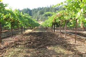
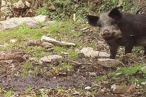
Whether you call them wild hogs, feral pigs, feral hogs, wild boars, Russian boars or Eurasian boars, by any name the hairy beasts are wrecking crews on California lands. In rangelands, forests and farms, wild pigs trample crops, prey on farm animals and rip up soil with their sharp tusks, contributing to erosion.
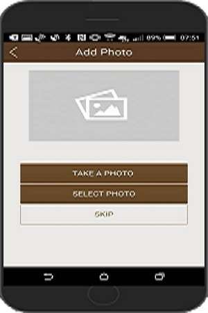
To assess the extent of wild pig damage to rural property in California, UC Cooperative Extension scientists are conducting a survey of landowners, land managers and farmers statewide. They have created a GIS-based mobile app that works on Android and Apple devices to make it easy to participate in the study.
“Rangeland managers and farmers can enter data into the app from the field so that we can estimate the land area and economic impacts of feral pig damage over a longer time period,” said Roger Baldwin, UC Cooperative Extension wildlife specialist in the Department of Wildlife, Fish, and Conservation Biology at UC Davis.
Here's how it works. To file a report, users take photos of the wild pig damage, describe the damage and note the number of pigs seen. The app will map the acreage and geographic location. Cell service is not required at the site to collect data.
When the user is connected to wi-fi or cell service, the data and photos will be uploaded to the UC Agriculture and Natural Resources server so Baldwin and John Harper, UC Cooperative Extension livestock and natural resources advisor, can analyze the data. Users will be able to see a map of wild pig damage, but to maintain user privacy, private property and user identities are blocked from the general public.
"The goal of the app is to demarcate wild pig damage, ultimately allowing us to relate this data to habitat features present at damage sites to determine the impact that these habitat components have, both on how pigs use the landscape and where damage is most likely to occur,” Baldwin said.