By Mary Hightower
After a gray day of gusts and heavy rain that steamrolled crops, Tropical Storm Laura seemed to save her worst for after sunset, with the nighttime hours punctuated by tornado warnings from Desha County north to Clay County.
Bryce Baldridge, a Lawrence County extension staff chair for the University of Arkansas System Division of Agriculture, heard the warnings Thursday night.
“They said a tornado was headed for Bono which is where I live,” he said on Friday.
“My daughter got the dog and headed for the bathtub,” Baldridge said, adding that he was “listening for that train noise to come out of the black sky.”
Fortunately, that sound never came.
Assessing past damage, worried about the next storm
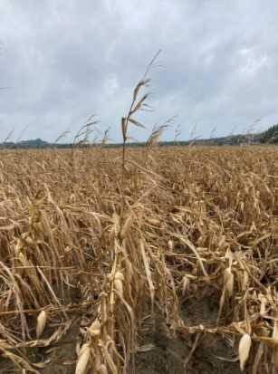
As daylight came Friday, farmers and extension agents and agronomists were making the rounds, trying to get a preliminary damage assessment. Laura’s arrival came just as corn and rice harvest began. At this time of year, soybeans are standing tall in some fields and cotton bolls are forming.
As these assessments continued through the day, agents and agronomists say they’re worried about another storm system expected to hit on Saturday.
Rice
Photos taken by extension personnel show swaths of flattened, or “lodged” plants in the heart of rice country. Jarrod Hardke, extension rice agronomist, said Friday that in an early round of assessments, it seems “rice damage is luckily minimal.”
“The damage appears worse in the south and lessens as you move north,” he said. However, “the closer to harvest the field is, the worse the impact, but cultivar, seeding rate and fertility are all impacting factors.”
With Saturday’s storms looming, Hardke said “lodging will worsen with time and rain.”
Soybeans
Matthew Davis, extension staff chair in Jackson County, said soybeans in his county seemed to have been the hardest hit.
“Soybeans have a lean to them,” he said. “Some that were 4 feet tall are around 2 feet tall now.”
Jeremy Ross, extension soybean agronomist, said “What I’ve seen are fields with tall soybean plants have a severe lean — they’re not completely flat.
“These fields should stand back up, but not completely,” he said. “They will have a lean the rest of the year. There shouldn’t be any yield impact, but they will be impossible to scout.”
In White County, Extension Agent Jan Yingling said she found roads covered with water and patches of fields leaning, but “my farmers have told me that most everything is still standing and they feel like they were spared.”
In Ashley County, along the Arkansas-Louisiana border, extension county chair Kevin Norton said that about 90 percent of the county’s cotton and soybean acreage had “some degree of lodging.”
“Cotton seems to be the hardest hit,” Norton said. “Corn is all over the board. I would estimate that 60 percent of corn acreage has some degree of lodging, ranging from 5 to 95 percent.”
Other damage
Cross County Extension Staff Chair Rick Wimberley, said rice and corn in his county was still standing for the most part, but soybeans were hit hard.
“I saw a lot of fields laying down. Don’t know if they can stand back up or not,” he said.
Wimberley, who is also a volunteer firefighter and a storm spotter, said “there was either a small tornado or straight line winds that broke tree limbs, uprooted trees, and blew down the city pavilion at Hickory Ridge.
“An airplane hangar was heavily damaged there, along with one aircraft that was undergoing maintenance,” he said. “The communications tower at the Hickory Ridge Fire Department was blown down along with a power pole. Many of the fields along a line from Hickory Ridge to approximately one mile east of Penrose are starting to flood. I expect floodwater to increase in the lower section of the county in this area the next couple of days because of poor drainage along a tributary know as Second Creek that flows into northern St. Francis County. This area has a history of flooding with heavy rains.”