By Mary Knapp et al.,
How well do you remember the weather events in Kansas last year? Let’s take a quick look back with this month-by-month highlight reel of the significant weather events affecting Kansas in 2019.
January
The highlight of January weather was the fluctuating temperatures. This pattern resulted in several freeze/thaw cycles in soil temperatures. While the wheat crop can typically withstand negative air temperatures well during the winter, this pattern can result in frost heaving of plants, with increased risk of damage to the roots and crown from the cold, particularly in poorly-established fields.
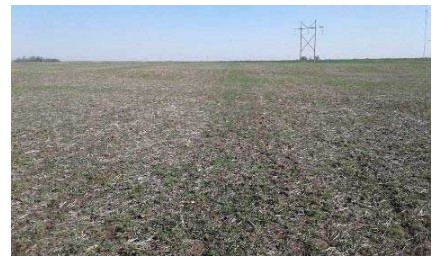
Figure 1. Poor wheat stand. Photo by Gretchen Sassenrath, K-State Research and Extension
February
Severe winter weather was the main feature for the month, with winter storm conditions across most of the state every weekend. Sadly, there were several fatal traffic accidents due to the snowy road conditions.
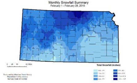
Figure 2. Monthly snowfall totals for February 2019. Source: Kansas Weather Data Library
March
The big severe weather event for March was the "bomb cyclone" on March 13. Winds increased dramatically late morning across western Kansas as the storm system strengthened in eastern Colorado. As the low shifted eastward into Kansas, the wind field expanded across the state. Strong winds continued through the duration of Wednesday and even strengthened into Thursday morning. Damage was reported to buildings, trees down across the state, and trucks were flipped as a result. More details can be found at: https://webapp.agron.ksu.edu/agr_social/article/kansas-weather-a-storm-for-the-record-books-324-6.
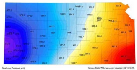
Figure 3. Map of low pressure measurements. Source: Kansas Mesonet
April
The 2019 tornado season began on April 17, when two of the six tornadoes for the month were reported in east central Kansas. The most destructive of these tornadoes occurred in Miami County on the 28th, when a church lost part of its roof. There were no reports of deaths or injuries with any of the tornadoes. Hail and damaging winds made up the bulk of the severe weather this month.
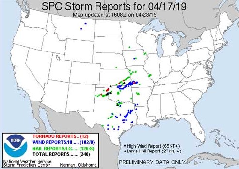
Figure 4. Storm reports for April 17, 2019. Source: Storm Prediction Center.
May
Spring rains came in earnest this month. May precipitation for the state averaged 10.26 inches, the wettest month since records began in 1895. The National Weather Service at Wichita at one time had river flood warnings for 43 river points! Some rivers reached levels not seen in over a decade or even longer. Major flood category was reached along the Neosho, Arkansas, Verdigris and Walnut rivers with numerous other rivers reaching moderate flood stage. Flooding was also reported on the Smokey Hill, Republican, Kansas, and Blue Rivers. Multiple Corps of Engineer flood control reservoirs reached over 90 percent of flood pool capacity. In addition to flooding, tornadoes were a problem. One of the most destructive tore through Linwood, KS on the 28th.
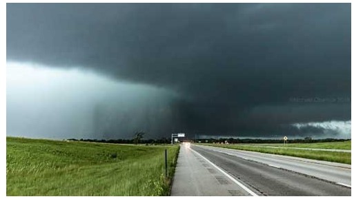
Figure 5. Tornado on the ground near Linwood, KS, on May 28, 2019. Photo from the National Weather Service.
June
While not as impressive as May, continued cool, wet weather was the major feature for June. The cooler and wetter conditions left wheat about 1 to 3 weeks behind normal depending on sowing date. Many wheat fields in the central and south-central regions drowned out due to excessive moisture. This caused extremely variable yields and test weight. Corn, soybeans, and sorghum continued to lag behind normal progress.
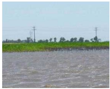
Figure 6. Flooded corn field. Photo by Doug Jardine, K-State Research and Extension.
July
The most dramatic feature was the switch in western Kansas to hot, dry conditions. Temperatures in western Kansas topped off at 107 oF and 108 oF during the week of July 21st. The rapid switch to drier conditions, coupled with warmer temperatures, resulted in stress to spring-planted crops.
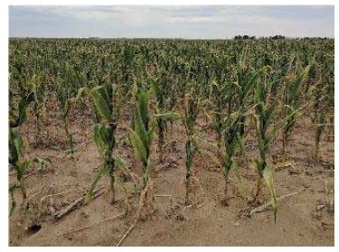
Figure 7. Heat-stressed corn. Photo by Chip Redmond, K-State Research and Extension.
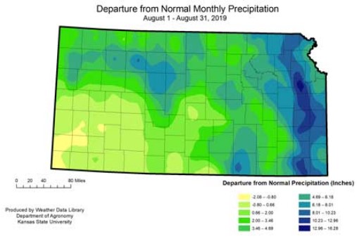
August
The most notable weather feature for August was the rainfall dichotomy. Statewide average precipitation ranked as the wettest August since 1895. However, much of the moisture was concentrated in the eastern third of the state. The East Central Division averaged 10.37 inches, over two and a half times normal. In contrast, the Southwest Division averaged 2.20 inches, just 80 percent of normal. Abnormally dry conditions began to develop in the Southwest, while saturated fields continued to cause problems in the east. These include sprouting, dropped ears, and mold in corn. Weed control was also a problem, as was putting up hay.