Figure 1). Accumulated precipitation for January 2 – 31, 2022. Figure courtesy of the Midwestern Regional Climate Center (https://mrcc.purdue.edu/).
Shortly after the first of the year however, the weather pattern turned much colder and has remained that way throughout the month. A heavy snowfall event dropped significant snow across the eastern counties, and lighter events have kept the ground covered with snow for much of the state. With snow in place, temperatures have been running 2-5°F below average for January. However, precipitation is running below average throughout the much of Ohio, 10-50% of normal across northwestern counties (Figure 1). Only far southern and eastern counties had a wetter than average month.
Forecast

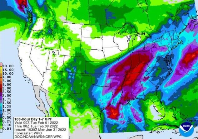
Figure 2). Precipitation forecast from the Weather Prediction Center for 7pm Monday Jan 31 – 7pm Monday Feb 7.
High pressure will slide off to the east on Tuesday, providing a southerly breeze and thawing temperatures, as highs reach the 40s to mid-50s across the state. A major winter storm will develop this week and push through Ohio on Wednesday through Thursday night. Significant rain, ice, and snow are forecast to fall across the state with numerous impacts. Highs will trend downward throughout the event, falling from 30s and 40s on Wednesday to the teens and 20s by Friday. Another Arctic plunge will likely cause overnight temperatures to fall below zero over the weekend. A return flow out of the south will bump temperatures back up closer to average as the weekend ends. The Weather Prediction Center is currently predicting 1.5-3.0” inches of liquid-equivalent precipitation over the next 7 days (Figure 2). According to the NOAA/NWS/Ohio River Forecast Center, warmer temperatures and precipitation falling on the existing snowpack will likely cause some runoff and may induce minor scattered flooding concerns across the state.
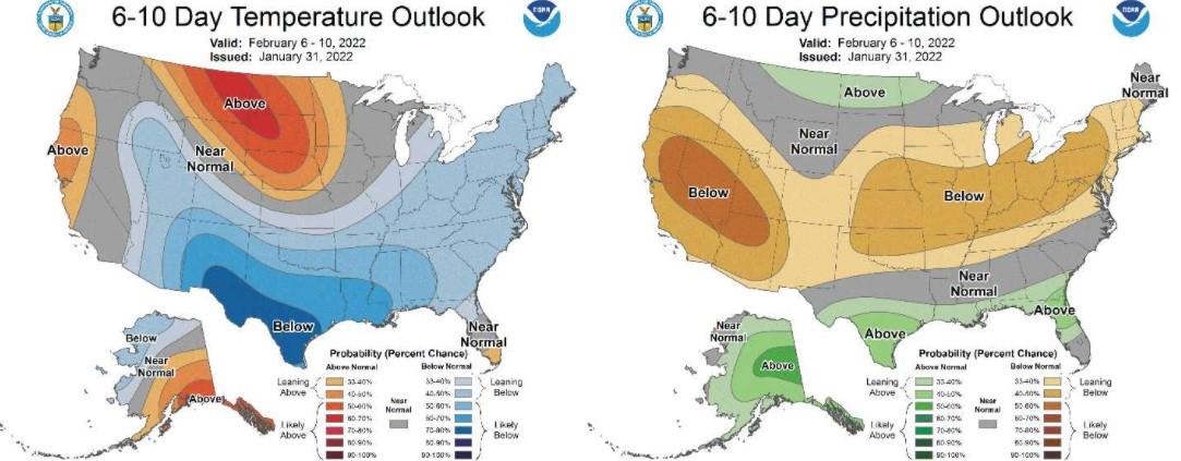
The Climate Prediction Center’s 6–10-day outlook for the period of February 6 - 9, 2022 and the 16-Day Rainfall Outlook from NOAA/NWS/Ohio River Forecast Center indicate that temperatures are likely to lean below average for the period with drier weather expected after this week’s major storm (Figure 3). Climate averages for this period begin their slow climb out of winter minimums, with a high temperature range of 36-41°F, a low temperature range of 21-24°F, and average liquid-equivalent precipitation of 0.50-0.70 inches.

Figure 3) Climate Prediction Center 6-10 Day Outlook valid for February 6-10, 2022, for left) temperatures and right) precipitation. Colors represent the probability of below, normal, or above normal conditions.
Source : osu.edu