By Jeff Wilson
Daily infrared images of U.S. farmland captured by satellite indicate worsening conditions for this year’s U.S. corn crop, according to one data-analysis company.
Domestic corn production will be 13.34 billion bushels, Descartes Labs forecast. That’s down 6.4 percent from last year and also less than the 13.53 billion-bushel forecast by the U.S. Department of Agriculture last month.
National corn yields are seen at 164.9 bushels an acre, down from its 168-bushel forecast last month, the Los Alamos, New Mexico-based company said. That’s also lower than the USDA forecast of 166.8 bushels from last month.
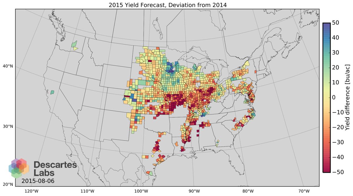
Problems caused by excessive rain from Nebraska to Ohio in June and July are clearly seen on computer-generated maps, said Chief Technology Officer Steven Brumby.
“The numbers have moved, and more than normal this year,” Brumby said in an interview Friday. “The full effect of the wet weather has yet to make itself known. The yield is probably headed lower.’
A theoretical physicist, Brumby is a co-founder of the company, which started as a project at the Los Alamos National Laboratory in 2007. Descartes analyzes images showing farmland to a resolution of 1/5 of an acre (0.8 hectare).
‘‘We can see what’s happening to the crop without having to go out into the fields,” Brumby said. “We are using time, space and color to see plants change.”
Descartes isn’t alone in forecasting a smaller crop than the USDA. The average estimate of 31 analysts and trading firms in a Bloomberg survey last week was for 13.332 billion bushels.